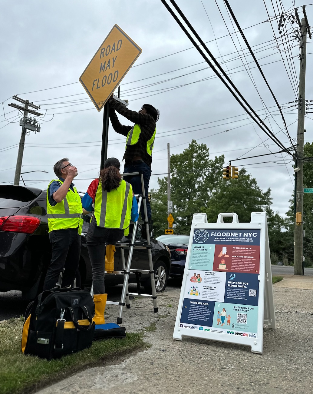
A flood sensor may be coming to a street near you.
FloodNet, a partnership that brings communities, research organizations and city government together to cope with flooding across New York City, is set to place around 500 elevated sensors citywide by the end of the year. The City New York University, the City University of New York, and the Mayor’s Office of Climate and Environmental Justice and the Department of Environmental Protection are taking part in the initiative.
Two sensors were recently placed in the South Bronx: one near the Longwood Ave. 6 subway station in May, and another at the corner of Halleck St. and Randall Ave in July.
Sensors, which are elevated about eight feet above the ground, use ultrasonic technology to provide real-time, accessible data for city officials and residents alike. Locations for these devices are chosen based on input from residents.
Veroneque Ignace, FloodNet’s community engagement manager, said flood data has traditionally been gleaned from 311 calls, which require residents to report flooding themselves.
“[FloodNet] sensors automate that,” Ignace said. “You don’t need to be up at 4 o’clock in the morning to say, ‘Hey, it’s flooding outside.’”
The project was launched in 2020 in response to extreme weather events like Hurricane Sandy in 2012 and Hurricane Ida in 2021.

When Tropical Storm Ophelia brought nearly nine inches of rain to the city last September, FloodNet sensors were one of the only real-time tools tracking the floods, according to Ignace.
“Our sensors were able to capture that flooding long before the city was able to declare a state of emergency,” she said. “It validated, as far as what the usefulness and the need is for a data network like this.”
Data gathered by the sensors is publicly available on FloodNet’s website. The organization says it can be used to alert the public about potential road closures and travel disruptions, as well as identify areas where assistance is required after storms. That would allow residents and organizations to “leverage it for their own solution making, and utilize that to even, let’s say, speak back to the city should they want.”
Grassroots organizations like South Bronx Unite and Bronx River Alliance are closely involved in the sensor deployment and flood planning process.
Christian Murphy, ecology and education manager at Bronx River Alliance, says he reached out to FloodNet after attending an information session in winter 2021.
“Flash flooding is becoming more of an issue in the Bronx River watershed than it has before,” he said. “We’re happy to be able to share their resources with our community partners and our audience as a way of keeping each other safe and learning about what areas are more at risk of flash flooding than others.”
Bronx River Alliance is updating its watershed plan to include data from FloodNet’s sensors.
FloodNet originally planned for 500 sensors by 2027, but the DEP asked them to accelerate the process so the sensors would be mounted by the end of this year.
“Climate change is bringing more intense rainfall,” said a DEP representative, in an email to the Herald. “We are accelerating the deployment of FloodNet in order to provide policymakers, and the public, with real-time information on flooding conditions as soon as possible.”
Murphy hopes FloodNet and projects like it will help increase public awareness about climate change and develop other projects to protect the city’s most vulnerable neighborhoods.
“FloodNet is a great example of what happens when the city gets involved with other experts like folks who work in academia and folks who are on the ground working in the community,” he said. “If it works well here, it can work well in other spaces, too.”