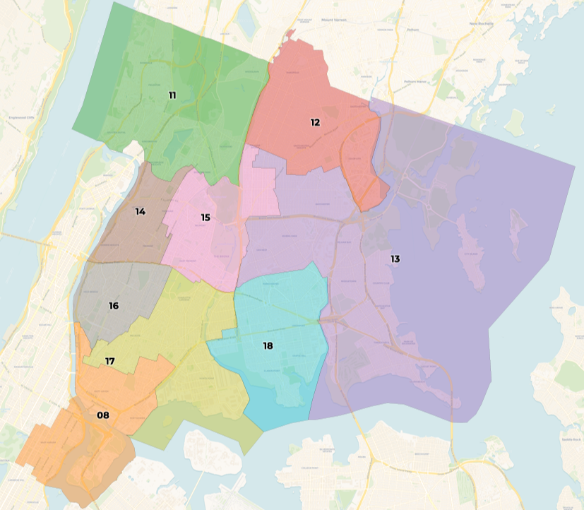
City Council districts in the South Bronx are likely to change, according to newly drafted maps of the city’s 51 Council districts drawn up by the New York City Districting Commission. The proposed new district lines were released to the public on Friday.
According to the proposed changes, parts of Longwood, Melrose and Port Morris east of the Bruckner Expressway would be added to District 8, which currently encompasses Mott Haven, Highbridge, Concourse, Longwood, Port Morris west of the Bruckner, and East Harlem. Councilwoman Diana Ayala has represented District 8 since 2018. The draft map for District 8 removes Highbridge and Concourse Village.
The tiny, industrially-zoned easternmost section of Port Morris that would change over is now in District 17, which is represented by Councilman Rafael Salamanca Jr., and extends from Hunts Point, Longwood, and Morrisania north through East Tremont. Salamanca will be term-limited out of his Council seat in 2024.
District 17’s lines would also change, with the northern boundary with the Cross Bronx expressway removed, and the area east to the Bronx River Parkway added on.
The Districting Commission says it has relied heavily on the census’ population numbers in drafting its changes, due in part to so few Bronxites having shown up to participate in the redistricting process so far. That could lead to less than desirable maps for the community.
Lisa Sorin, president of the Bronx Chamber of Commerce, said the changes proposed by the Districting Commission reflect economic changes in the South Bronx, including gentrification along the waterfront areas of Port Morris and Hunts Point, where residential development has been among the fastest-growing in the city. The decision to include the entirety of Port Morris in District 8 would help ensure that low-income residents are not excluded from the decision-making process, she said.
“It’s difficult because it’s not on the census yet, but we know it’s coming. So we’re trying to take measures to ensure no one gets left out,” said Sorin.
The city’s population has increased by more than a half-million people since the existing maps were drawn up in 2013. The Bronx alone has experienced a 6.6% population hike during that time.
The City Charter lists the criteria the Districting Commission must abide by in drawing up new maps. They are:
- Keep neighborhoods and communities intact
- Keep districts compact
- Limit district crossover between boroughs
- Avoid gerrymandering
- Avoid oddly shaped districts
The commission’s 15 appointed commissioners are proposing the current maps based on public hearings held in recent months, at which community members offered opinions on how they think their own Council districts should be represented.
New Yorkers will now have to wait for a second round of public hearings, scheduled for Aug. 15-17 & 22. The Commission will then vote to finalize new changes on Sept 22, before sending the maps to the City Council for approval.

