

Advocates unveil plan to reconnect residents to river
In the next few years, the concrete wasteland at the foot of Lincoln Avenue could be transformed into an inviting plaza, shaded by shrubs, trees and umbrellas and dotted with benches and tables, where Mott Havenites could gaze out at the Harlem River while they sipped a cup of coffee or nibbled a snack bought from a nearby vendor.
Or they might paddle a canoe to Randall’s Island or board a water bus to Mill Pond Park, Roberto Clemente State Park and a string of new riverside parks to the north.
The vision of a reborn connection between the Harlem River and the Bronx communities nearby was sketched at a forum at the Bronx Museum on June 11 that marked the completion of a community-based plan and the start of an effort to implement it neighborhood by neighborhood.
Lincoln Avenue, where no bridges are required to get to the river, is the low-hanging fruit in Mott Haven, requiring only a small investment of city funds, said Ron Schiffman of the Pratt Institute, who helped lead a brigade of students and their mentors to create a plan to transform the Harlem waterfront and make it accessible.

“It could be a magnificent gateway to the greenway, particularly if you have water transit to Clemente Park,” he told the audience of about 60 neighborhood activists, joined by community board members and elected officials and their representatives, who were brought together by the Harlem River Working Group to learn the results of months of study and community forums.
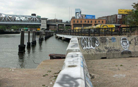
The plan also envisions natural areas where Park Avenue meets the river and at Pier 5 just north of the 149th Bridge.
The presenters did not address what might happen to the city-owned land just south of the Madison Avenue bridge, where a moving company’s lease expires in two years, but they did say some businesses should be relocated away from the river, and called for any future business development to be water-related—restaurants, boat rentals and markets, for example.
While they shied away from the controversy over FreshDirect’s relocation to the Harlem River Rail Yard, they insisted that industry, green space and recreation could co-exist. The rail yard offers “opportunities for access,” said Eve Baron, a senior fellow at Pratt who helped direct the study.
“We cross streets with more traffic” than use the rails, Schiff pointed out, saying that safe ways can be found to get across the train tracks that cut so much of Mott Haven and Port Morris off from the river. “The yards are publicly-owned and should be part of an access plan.”
Still, “the biggest challenge we need to overcome” along the length of the river is the barrier presented by the train tracks and by the Major Deegan Expressway, said Baron.

To overcome those barriers, she said, would take more than bridges and walkways: it would take programs to bring people to the river. So the plan envisions farmers markets, festivals, boat launches and a water-related museum, perhaps built on the Oak Point rail link in Port Morris, or a floating museum that would travel up and down the Harlem.
Despite the physical obstacles, the members of the working group were optimistic. They pointed to the recent acquisition of riverside land that will become a park at Depot Place, to the reopening of the High Bridge next year after a $62 million renovation, and to the engagement of the community in the current plan through three visioning sessions this spring.
A new round of community outreach will begin next month, and in October the Harlem River Working Group will sponsor a week-long river festival in Roberto Clemente Park.
“The 2000s was the decade of the Bronx River; the 2010s will be the decade of the Harlem River,” said Andy Stone of the Trust for Public Land, which facilitated the transfer of the Depot Place plot to the Parks Department.
The vision of the river’s future drew on 40 years of plans, and most especially on the work of MIT students and faculty last year. Like the MIT plan, it calls for plantings along much of the water’s edge and for parks at the Spuyten Duyvil train station and at Fordham Landing north of Fordham Road.
It envisions a boardwalk connecting Spuyten Duyvil and Marble Hill, expanding Macombs Dam Park to the river and sharing the Yankee Stadium Parking lot nearest the river for fairs and markets, as well as the new park and restored wetlands at Pier 5 and the plazas where Park and Lincoln Avenues meet the Harlem.
“Some of these ideas could be implemented tomorrow,” Schiff said, adding later in response to a question that transforming the end of Lincoln Avenue would be inexpensive, and chiefly required overcoming the bureaucratic reluctance to figuring out how to safeguard the rail crossing during the three times a day it is used by trains.
More ambitious and expensive ideas may have to wait years to be realized, he said, but the trick is to be ready with plans when opportunities present themselves.
By the end of June, the plan will be published as a pamphlet and on-line, said Chauncy Young, head of the Harlem River Working Group. Plans have come and gone, he acknowledged. “We’re trying to unite our communities to assure this one doesn’t just sit on a shelf.”
The Pratt Center has posted the slide show it used in its June 11 presentation on-line at http://inhabitat.com/nyc/harlem-river-community-revitalization-plan-showcases-new-vision-of-bronx-waterfront/
[…] New push to Harlem River shore begins […]
[…] 5 is part of the group’s larger goal of a connected greenway along the entire Bronx waterfront of the Harlem River, where, in contrast to the Manhattan side of […]
[…] New push to Harlem River shore begins […]
[…] have singled out Lincoln Avenue as a “gateway to the greenway.” Several of those plans also propose a soft edge along the property, where the addition of native […]